


Pic de Gleize (Topo Gap n°6)

frizou83
Gebruiker
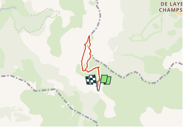

Lengte
5 km

Max. hoogte
2142 m

Positief hoogteverschil
443 m
Km-Effort
10,9 km

Min. hoogte
1693 m

Negatief hoogteverschil
442 m
Boucle
Ja
Datum van aanmaak :
2024-04-17 14:58:49.479
Laatste wijziging :
2024-04-17 14:59:47.877
2h28
Moeilijkheid : Medium

Gratisgps-wandelapplicatie
 SityTrail
IGN / Geografische instituten
SityTrail Plus
De wereld gaat voor u open
Over ons
Tocht Stappen van 5 km beschikbaar op Provence-Alpes-Côte d'Azur, Hautes-Alpes, Gap. Deze tocht wordt voorgesteld door frizou83.
Plaatsbepaling
Land:
France
Regio :
Provence-Alpes-Côte d'Azur
Departement/Provincie :
Hautes-Alpes
Gemeente :
Gap
Locatie:
Gap
Vertrek:(Dec)
Vertrek:(UTM)
265817 ; 4945282 (32T) N.
Opmerkingen