


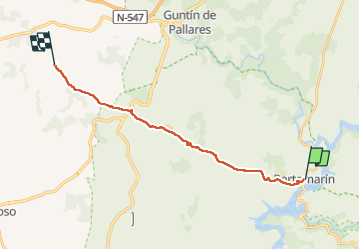
Portomarin Eirexe

Vinceneux
Gebruiker

Lengte
19 km

Max. hoogte
726 m

Positief hoogteverschil
487 m
Km-Effort
25 km

Min. hoogte
339 m

Negatief hoogteverschil
242 m
Boucle
Neen
Datum van aanmaak :
2024-05-18 05:44:28.755
Laatste wijziging :
2024-05-18 11:31:12.529
5h00
Moeilijkheid : Zeer moeilijk

Gratisgps-wandelapplicatie
 SityTrail
IGN / Geografische instituten
SityTrail Plus
De wereld gaat voor u open
Over ons
Tocht Stappen van 19 km beschikbaar op Galicië, Lugo, Portomarín. Deze tocht wordt voorgesteld door Vinceneux.
Foto's


29 fotos in totaal. Klik op een foto om ze allemaal in de galerij weer te geven.
Plaatsbepaling
Land:
Spain
Regio :
Galicië
Departement/Provincie :
Lugo
Gemeente :
Portomarín
Locatie:
Unknown
Vertrek:(Dec)
Vertrek:(UTM)
613206 ; 4740371 (29T) N.
Opmerkingen