


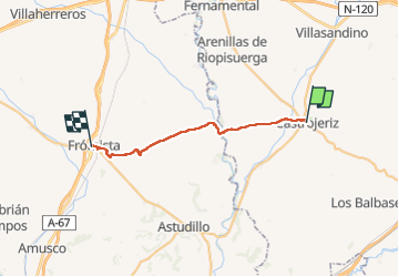
2024-5-21 Castrojeriz - Fromista

Christianlabourie
Gebruiker

Lengte
28 km

Max. hoogte
914 m

Positief hoogteverschil
324 m
Km-Effort
32 km

Min. hoogte
763 m

Negatief hoogteverschil
352 m
Boucle
Neen
Datum van aanmaak :
2024-05-21 05:31:21.349
Laatste wijziging :
2024-05-21 12:39:37.174
7h04
Moeilijkheid : Zeer moeilijk

Gratisgps-wandelapplicatie
 SityTrail
IGN / Geografische instituten
SityTrail Plus
De wereld gaat voor u open
Over ons
Tocht Stappen van 28 km beschikbaar op Castilië en León, Onbekend, Castrojeriz. Deze tocht wordt voorgesteld door Christianlabourie.
Plaatsbepaling
Land:
Spain
Regio :
Castilië en León
Departement/Provincie :
Onbekend
Gemeente :
Castrojeriz
Locatie:
Unknown
Vertrek:(Dec)
Vertrek:(UTM)
405867 ; 4682435 (30T) N.
Opmerkingen