


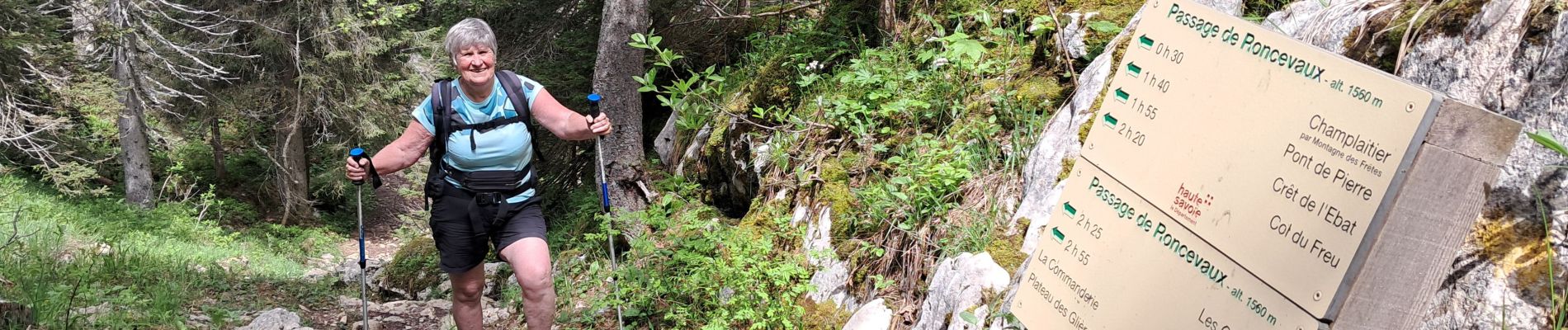
PAS DU ROC PUIS PASSAGE DE RONCEVAUX... VIA LE SENTIER DES ESPAGNOLS

djeepee74
Gebruiker

Lengte
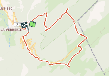
12,8 km

Max. hoogte
1595 m

Positief hoogteverschil
766 m
Km-Effort
23 km

Min. hoogte
923 m

Negatief hoogteverschil
755 m
Boucle
Ja
Datum van aanmaak :
2024-06-13 08:36:01.839
Laatste wijziging :
2024-06-14 16:39:20.578
5h12
Moeilijkheid : Medium

Gratisgps-wandelapplicatie
 SityTrail
IGN / Geografische instituten
SityTrail Plus
De wereld gaat voor u open
Over ons
Tocht Stappen van 12,8 km beschikbaar op Auvergne-Rhône-Alpes, Haute-Savoie, Fillière. Deze tocht wordt voorgesteld door djeepee74.
Beschrijving
Boucle... live du 20240613.
Le retour à la voiture se fait, en quittant le plateau des Glières, par le sentier coupant les lacets de la route, jusqu'au parking du pas du roc.
Foto's


Plaatsbepaling
Land:
France
Regio :
Auvergne-Rhône-Alpes
Departement/Provincie :
Haute-Savoie
Gemeente :
Fillière
Locatie:
Thorens-Glières
Vertrek:(Dec)
Vertrek:(UTM)
290746 ; 5094196 (32T) N.
Opmerkingen