Tocht Stappen Andon - 
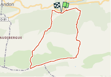
L'Audibergue du Pont du Loup - Photo
 GrouGary
GrouGary

Gebruiker

© OpenStreetMap contributors
Lengte
Lengte
10 km
Max. hoogte
Max. hoogte
1520 m
Positief hoogteverschil
470 m
Km-Effort
Km-Effort  
16,2 km
Min. hoogte
Min. hoogte
1071 m
Negatief hoogteverschil
470 m
Boucle
Boucle
Ja
Datum van aanmaak :
2024-06-14 06:30:04.489
Laatste wijziging :
2024-06-14 16:26:27.898

(0 Bericht)

Stappen
Stappen
5h21
Moeilijkheid : Gemakkelijk

Scan deze QR-code om de tocht te openen in de SityTrail-applicatie

Gratisgps-wandelapplicatie

Logo SityTrail SityTrail

IGN / Geografische instituten

SityTrail uit de App Store downloaden SityTrail uit Google Play downloaden

Logo SityTrail SityTrail Plus

De wereld gaat voor u open

SityTrail uit de App Store downloaden SityTrail uit Google Play downloaden SityTrail op Huawei AppGallery downloaden

Over ons

Tocht Stappen van 10 km beschikbaar op Provence-Alpes-Côte d'Azur, Alpes-Maritimes, Andon. Deze tocht wordt voorgesteld door GrouGary.

Beschrijving

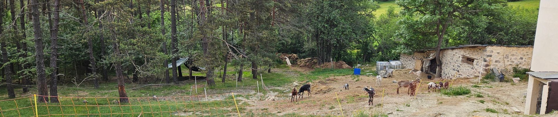
Petite boucle facile, dans une ambiance un peu "Mongolie" ;
Nombreuses fleurs de printemps
Température idéale (14° C à 9h AM...)

Ne pas oublier le détour à L'Audibergue, chez Christiana Restaurant (Excellents gateaux faits maison)

Hoogteprofiel

Foto's

Plaatsbepaling

Land:
France
Regio :
Provence-Alpes-Côte d'Azur
Departement/Provincie :
Alpes-Maritimes
Gemeente :
Andon
Locatie:
Unknown
Vertrek:(UTM)
324240 ; 4848700 (32T) N.


Sluiten
Mijn abonnementen