


Visite de Gaubertin

mathis01
Gebruiker

Lengte
14,7 km

Max. hoogte
117 m

Positief hoogteverschil
65 m
Km-Effort
15,5 km

Min. hoogte
97 m

Negatief hoogteverschil
65 m
Boucle
Ja
Datum van aanmaak :
2024-06-17 16:21:49.086
Laatste wijziging :
2025-02-17 09:53:41.553
3h31
Moeilijkheid : Gemakkelijk

Gratisgps-wandelapplicatie
 SityTrail
IGN / Geografische instituten
SityTrail Plus
De wereld gaat voor u open
Over ons
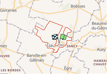
Tocht Te voet van 14,7 km beschikbaar op Centre-Val de Loire, Loiret, Gaubertin. Deze tocht wordt voorgesteld door mathis01.
Plaatsbepaling
Land:
France
Regio :
Centre-Val de Loire
Departement/Provincie :
Loiret
Gemeente :
Gaubertin
Locatie:
Unknown
Vertrek:(Dec)
Vertrek:(UTM)
457366 ; 5330068 (31U) N.
Opmerkingen