


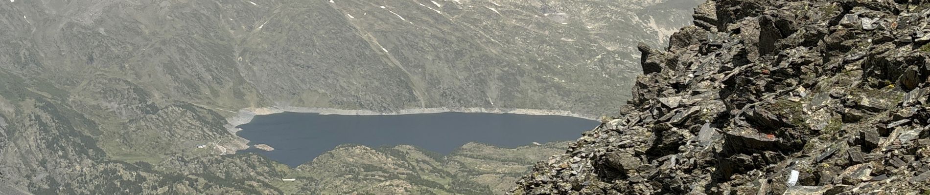
Mont Carlit

GeorgesV.
Gebruiker
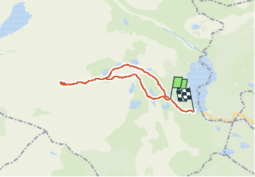

Lengte
13,3 km

Max. hoogte
2886 m

Positief hoogteverschil
771 m
Km-Effort
24 km

Min. hoogte
2038 m

Negatief hoogteverschil
879 m
Boucle
Neen
Datum van aanmaak :
2024-06-28 06:24:03.0
Laatste wijziging :
2024-06-28 15:04:45.677

Gratisgps-wandelapplicatie
 SityTrail
IGN / Geografische instituten
SityTrail Plus
De wereld gaat voor u open
Over ons
Tocht van 13,3 km beschikbaar op Occitanië, Pyrénées-Orientales, Angoustrine-Villeneuve-des-Escaldes. Deze tocht wordt voorgesteld door GeorgesV..
Foto's


Plaatsbepaling
Land:
France
Regio :
Occitanië
Departement/Provincie :
Pyrénées-Orientales
Gemeente :
Angoustrine-Villeneuve-des-Escaldes
Locatie:
Unknown
Vertrek:(Dec)
Vertrek:(UTM)
416700 ; 4712941 (31T) N.
Opmerkingen