


balisage GR10U 2024

LouisROGER
Gebruiker GUIDE
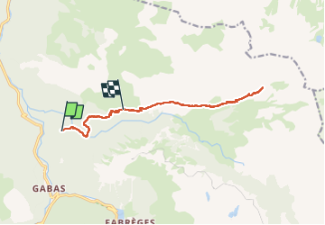

Lengte
14,5 km

Max. hoogte
1974 m

Positief hoogteverschil
1042 m
Km-Effort
27 km

Min. hoogte
1108 m

Negatief hoogteverschil
588 m
Boucle
Neen
Datum van aanmaak :
2024-07-17 05:35:14.551
Laatste wijziging :
2024-07-17 18:01:02.504
9h33
Moeilijkheid : Zeer moeilijk

Gratisgps-wandelapplicatie
 SityTrail
IGN / Geografische instituten
SityTrail Plus
De wereld gaat voor u open
Over ons
Tocht Stappen van 14,5 km beschikbaar op Nieuw-Aquitanië, Pyrénées-Atlantiques, Laruns. Deze tocht wordt voorgesteld door LouisROGER.
Foto's

Plaatsbepaling
Land:
France
Regio :
Nieuw-Aquitanië
Departement/Provincie :
Pyrénées-Atlantiques
Gemeente :
Laruns
Locatie:
Unknown
Vertrek:(Dec)
Vertrek:(UTM)
710365 ; 4753544 (30T) N.
Opmerkingen