


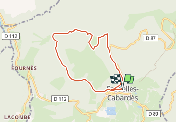
Roc de Nouret à Pradelles Cabardès

SoleilMoussanais
Gebruiker

Lengte
7,8 km

Max. hoogte
1068 m

Positief hoogteverschil
296 m
Km-Effort
11,7 km

Min. hoogte
832 m

Negatief hoogteverschil
296 m
Boucle
Ja
Datum van aanmaak :
2024-07-22 17:43:38.677
Laatste wijziging :
2024-07-22 17:48:00.785
3h00
Moeilijkheid : Medium

Gratisgps-wandelapplicatie
 SityTrail
IGN / Geografische instituten
SityTrail Plus
De wereld gaat voor u open
Over ons
Tocht Te voet van 7,8 km beschikbaar op Occitanië, Aude, Pradelles-Cabardès. Deze tocht wordt voorgesteld door SoleilMoussanais.
Beschrijving
A proximité du Pic de Nore, à la découverte du Roc Nouret, de la Cabane d'Hélène, de la source des Bayours, et des anciennes glacières.
Plaatsbepaling
Land:
France
Regio :
Occitanië
Departement/Provincie :
Aude
Gemeente :
Pradelles-Cabardès
Locatie:
Unknown
Vertrek:(Dec)
Vertrek:(UTM)
455128 ; 4806321 (31T) N.
Opmerkingen