


Running Condette

Baltykatt
Gebruiker

Lengte
4,9 km

Max. hoogte
71 m

Positief hoogteverschil
51 m
Km-Effort
5,6 km

Min. hoogte
28 m

Negatief hoogteverschil
51 m
Boucle
Ja
Datum van aanmaak :
2024-08-27 19:14:19.971
Laatste wijziging :
2024-08-27 19:14:21.037
1h00
Moeilijkheid : Gemakkelijk
35m
Moeilijkheid : Gemakkelijk

Gratisgps-wandelapplicatie
 SityTrail
IGN / Geografische instituten
SityTrail Plus
De wereld gaat voor u open
Over ons
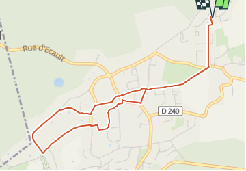
Tocht Stappen van 4,9 km beschikbaar op Hauts-de-France, Pas-de-Calais, Condette. Deze tocht wordt voorgesteld door Baltykatt.
Plaatsbepaling
Land:
France
Regio :
Hauts-de-France
Departement/Provincie :
Pas-de-Calais
Gemeente :
Condette
Locatie:
Unknown
Vertrek:(Dec)
Vertrek:(UTM)
403461 ; 5612692 (31U) N.
Opmerkingen