


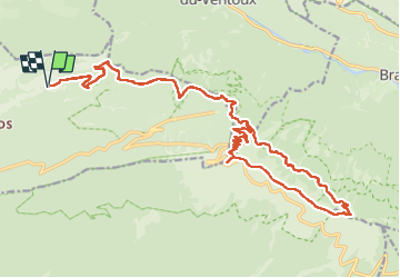
Ventoux(28.5K 1480D+)

kayamb
Gebruiker

Lengte
29 km

Max. hoogte
1907 m

Positief hoogteverschil
1478 m
Km-Effort
48 km

Min. hoogte
598 m

Negatief hoogteverschil
1481 m
Boucle
Ja
Datum van aanmaak :
2024-08-31 04:47:03.0
Laatste wijziging :
2024-08-31 16:52:51.583
5h41
Moeilijkheid : Moeilijk

Gratisgps-wandelapplicatie
 SityTrail
IGN / Geografische instituten
SityTrail Plus
De wereld gaat voor u open
Over ons
Tocht Trail van 29 km beschikbaar op Provence-Alpes-Côte d'Azur, Vaucluse, Beaumont-du-Ventoux. Deze tocht wordt voorgesteld door kayamb.
Plaatsbepaling
Land:
France
Regio :
Provence-Alpes-Côte d'Azur
Departement/Provincie :
Vaucluse
Gemeente :
Beaumont-du-Ventoux
Locatie:
Unknown
Vertrek:(Dec)
Vertrek:(UTM)
677672 ; 4895417 (31T) N.
Opmerkingen