


montabes

bouscaillou
Gebruiker
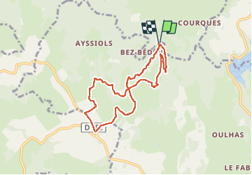

Lengte
8 km

Max. hoogte
765 m

Positief hoogteverschil
284 m
Km-Effort
11,8 km

Min. hoogte
493 m

Negatief hoogteverschil
282 m
Boucle
Ja
Datum van aanmaak :
2024-09-12 12:18:40.063
Laatste wijziging :
2024-09-12 15:02:44.947
2h43
Moeilijkheid : Medium

Gratisgps-wandelapplicatie
 SityTrail
IGN / Geografische instituten
SityTrail Plus
De wereld gaat voor u open
Over ons
Tocht Stappen van 8 km beschikbaar op Occitanië, Aveyron, Florentin-la-Capelle. Deze tocht wordt voorgesteld door bouscaillou.
Plaatsbepaling
Land:
France
Regio :
Occitanië
Departement/Provincie :
Aveyron
Gemeente :
Florentin-la-Capelle
Locatie:
Unknown
Vertrek:(Dec)
Vertrek:(UTM)
471993 ; 4945913 (31T) N.
Opmerkingen