


Valnontey

chgarit
Gebruiker

Lengte
12,8 km

Max. hoogte
1742 m

Positief hoogteverschil
235 m
Km-Effort
15,9 km

Min. hoogte
1535 m

Negatief hoogteverschil
235 m
Boucle
Ja
Datum van aanmaak :
2024-09-25 08:28:22.0
Laatste wijziging :
2024-09-25 13:20:32.392
3h07
Moeilijkheid : Gemakkelijk

Gratisgps-wandelapplicatie
 SityTrail
IGN / Geografische instituten
SityTrail Plus
De wereld gaat voor u open
Over ons
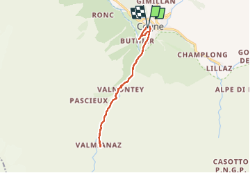
Tocht Stappen van 12,8 km beschikbaar op Valle d'Aosta, Onbekend, Cogne. Deze tocht wordt voorgesteld door chgarit.
Plaatsbepaling
Land:
Italy
Regio :
Valle d'Aosta
Departement/Provincie :
Onbekend
Gemeente :
Cogne
Locatie:
Unknown
Vertrek:(Dec)
Vertrek:(UTM)
371718 ; 5051847 (32T) N.
Opmerkingen