


SityTrail - 2023-06-22 Chevreuse Dampierre journée

Rando MLC
Gebruiker

Lengte
18,6 km

Max. hoogte
178 m

Positief hoogteverschil
456 m
Km-Effort
25 km

Min. hoogte
77 m

Negatief hoogteverschil
450 m
Boucle
Ja
Datum van aanmaak :
2024-09-29 15:38:58.283
Laatste wijziging :
2024-09-29 16:19:21.783
5h36
Moeilijkheid : Medium

Gratisgps-wandelapplicatie
 SityTrail
IGN / Geografische instituten
SityTrail Plus
De wereld gaat voor u open
Over ons
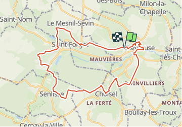
Tocht Stappen van 18,6 km beschikbaar op Île-de-France, Yvelines, Chevreuse. Deze tocht wordt voorgesteld door Rando MLC.
Plaatsbepaling
Land:
France
Regio :
Île-de-France
Departement/Provincie :
Yvelines
Gemeente :
Chevreuse
Locatie:
Unknown
Vertrek:(Dec)
Vertrek:(UTM)
428730 ; 5395382 (31U) N.
Opmerkingen