


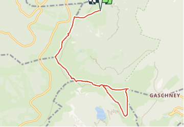
Vosges: Petit et Grand Hohneck

MathieuBourgois
Gebruiker

Lengte
9,4 km

Max. hoogte
1350 m

Positief hoogteverschil
421 m
Km-Effort
15,1 km

Min. hoogte
1132 m

Negatief hoogteverschil
421 m
Boucle
Ja
Datum van aanmaak :
2024-10-08 16:39:01.177
Laatste wijziging :
2024-10-08 16:40:03.919
3h25
Moeilijkheid : Gemakkelijk

Gratisgps-wandelapplicatie
 SityTrail
IGN / Geografische instituten
SityTrail Plus
De wereld gaat voor u open
Over ons
Tocht Te voet van 9,4 km beschikbaar op Grand Est, Haut-Rhin, Stosswihr. Deze tocht wordt voorgesteld door MathieuBourgois.
Beschrijving
10km 425D
Plaatsbepaling
Land:
France
Regio :
Grand Est
Departement/Provincie :
Haut-Rhin
Gemeente :
Stosswihr
Locatie:
Unknown
Vertrek:(Dec)
Vertrek:(UTM)
352818 ; 5324118 (32U) N.
Opmerkingen