


Item

GeorgesV.
Gebruiker

Lengte
11,8 km

Max. hoogte
1570 m

Positief hoogteverschil
833 m
Km-Effort
23 km

Min. hoogte
812 m

Negatief hoogteverschil
833 m
Boucle
Ja
Datum van aanmaak :
2024-11-11 07:36:16.0
Laatste wijziging :
2024-11-11 14:17:43.175

Gratisgps-wandelapplicatie
 SityTrail
IGN / Geografische instituten
SityTrail Plus
De wereld gaat voor u open
Over ons
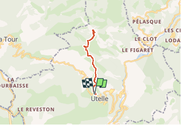
Tocht van 11,8 km beschikbaar op Provence-Alpes-Côte d'Azur, Alpes-Maritimes, Utelle. Deze tocht wordt voorgesteld door GeorgesV..
Plaatsbepaling
Land:
France
Regio :
Provence-Alpes-Côte d'Azur
Departement/Provincie :
Alpes-Maritimes
Gemeente :
Utelle
Locatie:
Unknown
Vertrek:(Dec)
Vertrek:(UTM)
359063 ; 4864369 (32T) N.
Opmerkingen