


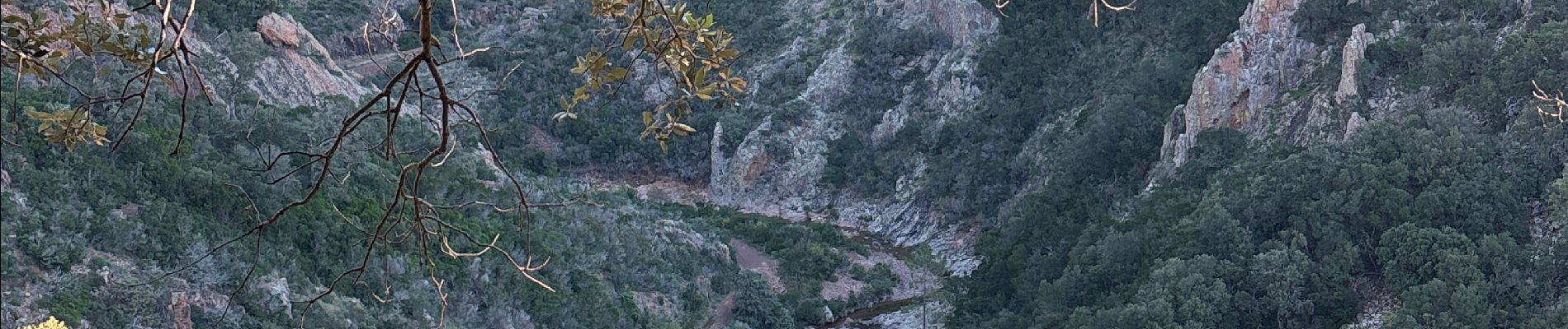
Perthus Occidental depuis la font du pommier

GeorgesV.
Gebruiker
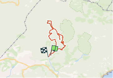

Lengte
13,4 km

Max. hoogte
317 m

Positief hoogteverschil
423 m
Km-Effort
19 km

Min. hoogte
16 m

Negatief hoogteverschil
422 m
Boucle
Neen
Datum van aanmaak :
2024-11-15 07:24:35.0
Laatste wijziging :
2024-11-15 12:23:17.931

Gratisgps-wandelapplicatie
 SityTrail
IGN / Geografische instituten
SityTrail Plus
De wereld gaat voor u open
Over ons
Tocht van 13,4 km beschikbaar op Provence-Alpes-Côte d'Azur, Var, Saint-Raphaël. Deze tocht wordt voorgesteld door GeorgesV..
Foto's

Plaatsbepaling
Land:
France
Regio :
Provence-Alpes-Côte d'Azur
Departement/Provincie :
Var
Gemeente :
Saint-Raphaël
Locatie:
Unknown
Vertrek:(Dec)
Vertrek:(UTM)
325407 ; 4814066 (32T) N.
Opmerkingen