Tocht Stappen Palau-del-Vidre - PALAU-DEL-VIDRE 66 - Boucle de Villeclare - promenade dans les vergers et cultures maraîchères  - Photo

PALAU-DEL-VIDRE 66 - Boucle de Villeclare - promenade dans les vergers et cultures maraîchères

 jeff66
jeff66

Gebruiker

© OpenStreetMap contributors
Lengte
Lengte
7,5 km
Max. hoogte
Max. hoogte
42 m
Positief hoogteverschil
35 m
Km-Effort
Km-Effort  
7,9 km
Min. hoogte
Min. hoogte
20 m
Negatief hoogteverschil
36 m
Boucle
Boucle
Ja
Datum van aanmaak :
2015-05-29 00:00:00.0
Laatste wijziging :
2015-05-29 00:00:00.0

(2 Bericht)

Stappen
Stappen
1h16
Moeilijkheid : Gemakkelijk

Scan deze QR-code om de tocht te openen in de SityTrail-applicatie

Gratisgps-wandelapplicatie

Logo SityTrail SityTrail

IGN / Geografische instituten

SityTrail uit de App Store downloaden SityTrail uit Google Play downloaden

Logo SityTrail SityTrail World

De wereld gaat voor u open

SityTrail uit de App Store downloaden SityTrail uit Google Play downloaden SityTrail op Huawei AppGallery downloaden

Over ons

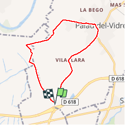
Tocht Stappen van 7,5 km beschikbaar op Occitanië, Pyrénées-Orientales, Palau-del-Vidre. Deze tocht wordt voorgesteld door jeff66.

Beschrijving

PALAU-DEL-VIDRE 66 - Bosc del vilaclara - El trompill - canal de Palau - gué sur le tanyari - castell de Bles - mas PUIG - les garrigues. - Aigalls - pont sur le Tanyari - Mas Batlle - PALAU - médiathèque groupe scolaire - cimetière - Mas Civada - château et Chapelle de Villeclare - la Teuleria - la Gavarra - vue sur les Alberes

Hoogteprofiel

Foto's

Plaatsbepaling

Land:
France
Regio :
Occitanië
Departement/Provincie :
Pyrénées-Orientales
Gemeente :
Palau-del-Vidre
Locatie:
Unknown
Vertrek:(Dec)
Vertrek:(UTM)
495402 ; 4711010 (31T) N.

Opmerkingen

Gelieve in te loggen om een commentaar of een beoordeling achter te laten


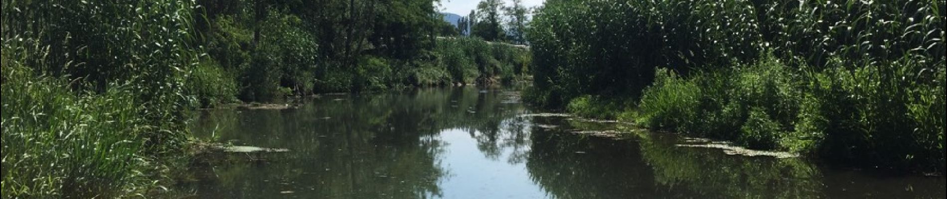
mooie en rustige wandeling tussen afwisselende natuur


Balade agréable uniquement sur petites routes goudronnées


Wandeltochten in de omgeving

Tocht Stappen Laroque-des-Albères - 66 LAROQUE DES ALBERES (maison) SOREDE, par pistes DFCI AL12 et 19, mas del Ca et mas Manere, Itin.16  - Photo
Stappen
jeff66

Stappen

Medium
(1)
Laroque-des-Albères, Occitanië, Pyrénées-Orientales, France
11,2 km | 15,3 km-effort
2h 5min
Ja
Tocht Stappen Laroque-des-Albères - 66 SOREDE, LAROQUE DES ALBERES, chemins des Mas - Photo
Stappen
jeff66

Stappen

Medium
(1)
Laroque-des-Albères, Occitanië, Pyrénées-Orientales, France
7 km | 8,9 km-effort
1h 22min
Ja
Tocht Stappen Saint-André - 66 SAINT-ANDRE - SOREDE - chapelle Saint Ferreol de la Pava  - Photo
Stappen
jeff66

Stappen

Medium
(1)
Saint-André, Occitanië, Pyrénées-Orientales, France
14,2 km | 16,9 km-effort
2h 25min
Ja
Tocht Stappen Sorède - Utrera Font Miracles T - Photo
Stappen
force

Stappen

Medium
(1)
Sorède, Occitanië, Pyrénées-Orientales, France
10,7 km | 17,6 km-effort
3h 50min
Ja
Tocht Stappen Sorède - 577. 11km sorede roc des medes  - Photo
Stappen
Erius

Stappen

Medium
(1)
Sorède, Occitanië, Pyrénées-Orientales, France
10,5 km | 18,2 km-effort
3h 42min
Ja
Tocht Stappen Laroque-des-Albères - Col-Ullat Pic-aureille_Terrain - Photo
Stappen
force

Stappen

Medium
(1)
Laroque-des-Albères, Occitanië, Pyrénées-Orientales, France
11,2 km | 23 km-effort
4h 47min
Ja
Tocht Te voet Sorède - Vallée Heureuse - Château d'Ultrera - Photo
Te voet
PRO

Te voet

Gemakkelijk
Sorède, Occitanië, Pyrénées-Orientales, France
10,9 km | 19,4 km-effort
4h 23min
Ja
Tocht Stappen Brouilla - RP66 BROUILLA - BANYULS DELS ASPRES - par les bords de Tech et Vignobles - le 31.03.2017 - Photo
Stappen
jeff66

Stappen

Gemakkelijk
(3)
Brouilla, Occitanië, Pyrénées-Orientales, France
7,5 km | 8,3 km-effort
1h 26min
Ja
Tocht Stappen Sorède - RP66 SOREDE - ND du château - la vallée heureuse  - Photo
Stappen
jeff66

Stappen

Medium
(1)
Sorède, Occitanië, Pyrénées-Orientales, France
10,2 km | 14,9 km-effort
1h 48min
Ja


Sluiten
Mijn abonnementen