


Viols-en-Laval Cambous

gadafo
Gebruiker

Lengte
8,8 km

Max. hoogte
290 m

Positief hoogteverschil
113 m
Km-Effort
10,3 km

Min. hoogte
235 m

Negatief hoogteverschil
112 m
Boucle
Ja
Datum van aanmaak :
2024-11-23 07:57:13.745
Laatste wijziging :
2024-11-23 08:16:47.15
2h20
Moeilijkheid : Medium

Gratisgps-wandelapplicatie
 SityTrail
IGN / Geografische instituten
SityTrail Plus
De wereld gaat voor u open
Over ons
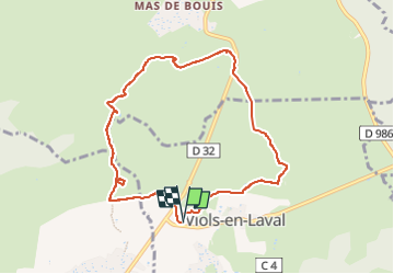
Tocht Stappen van 8,8 km beschikbaar op Occitanië, Hérault, Viols-en-Laval. Deze tocht wordt voorgesteld door gadafo.
Plaatsbepaling
Land:
France
Regio :
Occitanië
Departement/Provincie :
Hérault
Gemeente :
Viols-en-Laval
Locatie:
Unknown
Vertrek:(Dec)
Vertrek:(UTM)
557738 ; 4844498 (31T) N.
Opmerkingen