


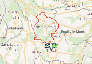
Theizé, Jarnioux, St Clair, St Abram, Les Fontaines, Le Bancillon

Mariolebeno
Gebruiker

Lengte
14,3 km

Max. hoogte
650 m

Positief hoogteverschil
497 m
Km-Effort
21 km

Min. hoogte
315 m

Negatief hoogteverschil
496 m
Boucle
Ja
Datum van aanmaak :
2024-12-06 09:18:38.496
Laatste wijziging :
2024-12-09 08:21:27.725
4h44
Moeilijkheid : Zeer moeilijk

Gratisgps-wandelapplicatie
 SityTrail
IGN / Geografische instituten
SityTrail Plus
De wereld gaat voor u open
Over ons
Tocht Stappen van 14,3 km beschikbaar op Auvergne-Rhône-Alpes, Rhône, Theizé. Deze tocht wordt voorgesteld door Mariolebeno.
Plaatsbepaling
Land:
France
Regio :
Auvergne-Rhône-Alpes
Departement/Provincie :
Rhône
Gemeente :
Theizé
Locatie:
Unknown
Vertrek:(Dec)
Vertrek:(UTM)
625241 ; 5088555 (31T) N.
Opmerkingen