


2024-12-15_17h34m48_fouran (tête de par ravin du clot)

orsel
Gebruiker GUIDE
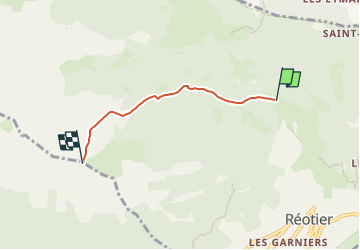

Lengte
3,4 km

Max. hoogte
2443 m

Positief hoogteverschil
934 m
Km-Effort
12,7 km

Min. hoogte
1500 m

Negatief hoogteverschil
0 m
Boucle
Neen
Datum van aanmaak :
2024-12-15 16:34:48.525
Laatste wijziging :
2024-12-15 16:34:49.075

Gratisgps-wandelapplicatie
 SityTrail
IGN / Geografische instituten
SityTrail Plus
De wereld gaat voor u open
Over ons
Tocht van 3,4 km beschikbaar op Provence-Alpes-Côte d'Azur, Hautes-Alpes, Réotier. Deze tocht wordt voorgesteld door orsel.
Plaatsbepaling
Land:
France
Regio :
Provence-Alpes-Côte d'Azur
Departement/Provincie :
Hautes-Alpes
Gemeente :
Réotier
Locatie:
Unknown
Vertrek:(Dec)
Vertrek:(UTM)
308463 ; 4950317 (32T) N.
Opmerkingen