


06-06.2015 -

babeth35
Gebruiker

Lengte
25 km

Max. hoogte
24 m

Positief hoogteverschil
236 m
Km-Effort
29 km

Min. hoogte
-3 m

Negatief hoogteverschil
237 m
Boucle
Ja
Datum van aanmaak :
2015-06-07 00:00:00.0
Laatste wijziging :
2020-07-20 15:53:52.524
7h04
Moeilijkheid : Gemakkelijk

Gratisgps-wandelapplicatie
 SityTrail
IGN / Geografische instituten
SityTrail Plus
De wereld gaat voor u open
Over ons
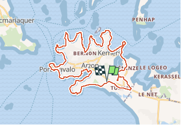
Tocht Stappen van 25 km beschikbaar op Bretagne, Morbihan, Arzon. Deze tocht wordt voorgesteld door babeth35.
Plaatsbepaling
Land:
France
Regio :
Bretagne
Departement/Provincie :
Morbihan
Gemeente :
Arzon
Locatie:
Unknown
Vertrek:(Dec)
Vertrek:(UTM)
509030 ; 5265216 (30T) N.
Opmerkingen