


2025-02-03_23h18m21_chapelle_saint_pierre-20632079-1738506772-50

rlebasque
Gebruiker
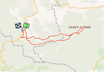

Lengte
16,1 km

Max. hoogte
600 m

Positief hoogteverschil
481 m
Km-Effort
23 km

Min. hoogte
383 m

Negatief hoogteverschil
480 m
Boucle
Ja
Datum van aanmaak :
2025-02-03 22:18:21.467
Laatste wijziging :
2025-02-03 22:18:22.222

Gratisgps-wandelapplicatie
 SityTrail
IGN / Geografische instituten
SityTrail Plus
De wereld gaat voor u open
Over ons
Tocht van 16,1 km beschikbaar op Provence-Alpes-Côte d'Azur, Bouches-du-Rhône, Jouques. Deze tocht wordt voorgesteld door rlebasque.
Plaatsbepaling
Land:
France
Regio :
Provence-Alpes-Côte d'Azur
Departement/Provincie :
Bouches-du-Rhône
Gemeente :
Jouques
Locatie:
Unknown
Vertrek:(Dec)
Vertrek:(UTM)
713346 ; 4829813 (31T) N.
Opmerkingen