Tocht Te voet Sohland an der Spree - CZ-This is originaly german learning path, not czech. It has german and czech text on the infotables. - Photo

CZ-This is originaly german learning path, not czech. It has german and czech text on the infotables.

Tous les sentiers balisés d’Europe GUIDE+

© OpenStreetMap contributors
Lengte
Lengte
7,3 km
Max. hoogte
Max. hoogte
492 m
Positief hoogteverschil
296 m
Km-Effort
Km-Effort  
10,7 km
Min. hoogte
Min. hoogte
328 m
Negatief hoogteverschil
145 m
Boucle
Boucle
Neen
Markering
Markering
Datum van aanmaak :
2025-02-07 06:30:50.937
Laatste wijziging :
2025-02-07 06:30:50.937

(0 Bericht)

Te voet
Te voet
2h26
Moeilijkheid : Gemakkelijk

Scan deze QR-code om de tocht te openen in de SityTrail-applicatie

Gratisgps-wandelapplicatie

Logo SityTrail SityTrail

IGN / Geografische instituten

SityTrail uit de App Store downloaden SityTrail uit Google Play downloaden

Logo SityTrail SityTrail Plus

De wereld gaat voor u open

SityTrail uit de App Store downloaden SityTrail uit Google Play downloaden SityTrail op Huawei AppGallery downloaden

Over ons

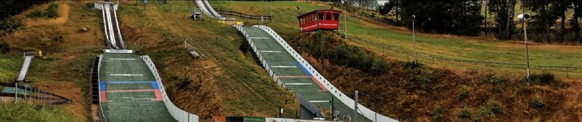
Tocht Te voet van 7,3 km beschikbaar op Saksen, Bautzen, Sohland an der Spree. Deze tocht wordt voorgesteld door SityTrail - itinéraires balisés pédestres.

Beschrijving

This is originaly german learning path, not czech. It has german and czech text on the infotables.

Hoogteprofiel

Foto's

Plaatsbepaling

Land:
Germany
Regio :
Saksen
Departement/Provincie :
Bautzen
Gemeente :
Sohland an der Spree
Locatie:
Unknown
Vertrek:(UTM)
460993 ; 5653745 (33U) N.


Sluiten
Mijn abonnementen