


GRP-162 - Parcours Principal - 2024-12-02

collignpn
Gebruiker GUIDE
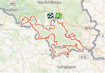

Lengte
271 km

Max. hoogte
439 m

Positief hoogteverschil
5428 m
Km-Effort
343 km

Min. hoogte
188 m

Negatief hoogteverschil
5431 m
Boucle
Ja
Datum van aanmaak :
2025-02-14 13:05:25.11
Laatste wijziging :
2025-02-21 08:58:51.075
77h57
Moeilijkheid : Zeer moeilijk

Gratisgps-wandelapplicatie
 SityTrail
IGN / Geografische instituten
SityTrail Plus
De wereld gaat voor u open
Over ons
Tocht Te voet van 271 km beschikbaar op Wallonië, Luxemburg, Tintigny. Deze tocht wordt voorgesteld door collignpn.
Beschrijving
GRP-162 - Parcours Principal
POI's


Plaatsbepaling
Land:
Belgium
Regio :
Wallonië
Departement/Provincie :
Luxemburg
Gemeente :
Tintigny
Locatie:
Unknown
Vertrek:(Dec)
Vertrek:(UTM)
679212 ; 5510157 (31U) N.
Opmerkingen