


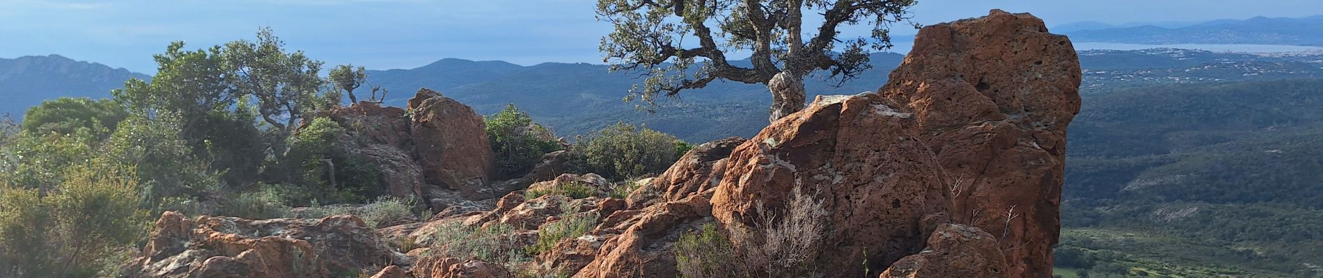
MF et Barre du Roussiveau - Pic Perthus Occidental

LtZIP
Gebruiker
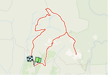

Lengte
5,7 km

Max. hoogte
284 m

Positief hoogteverschil
234 m
Km-Effort
8,8 km

Min. hoogte
80 m

Negatief hoogteverschil
237 m
Boucle
Ja
Datum van aanmaak :
2025-02-16 07:56:24.83
Laatste wijziging :
2025-02-18 17:08:14.484
1h54
Moeilijkheid : Gemakkelijk

Gratisgps-wandelapplicatie
 SityTrail
IGN / Geografische instituten
SityTrail Plus
De wereld gaat voor u open
Over ons
Tocht Stappen van 5,7 km beschikbaar op Provence-Alpes-Côte d'Azur, Var, Saint-Raphaël. Deze tocht wordt voorgesteld door LtZIP.
Foto's


Plaatsbepaling
Land:
France
Regio :
Provence-Alpes-Côte d'Azur
Departement/Provincie :
Var
Gemeente :
Saint-Raphaël
Locatie:
Unknown
Vertrek:(Dec)
Vertrek:(UTM)
325324 ; 4815188 (32T) N.
Opmerkingen