


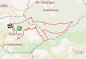
Fauzieres jolie balade, fangouze, belle montée et retour dans la foret

jeff2
Gebruiker

Lengte
12,5 km

Max. hoogte
674 m

Positief hoogteverschil
434 m
Km-Effort
18,3 km

Min. hoogte
306 m

Negatief hoogteverschil
438 m
Boucle
Neen
Datum van aanmaak :
2025-02-20 09:07:39.148
Laatste wijziging :
2025-02-20 13:51:47.974
4h04
Moeilijkheid : Medium

Gratisgps-wandelapplicatie
 SityTrail
IGN / Geografische instituten
SityTrail Plus
De wereld gaat voor u open
Over ons
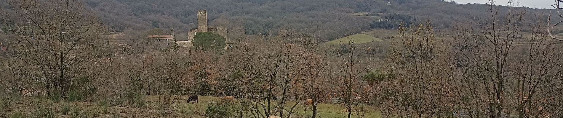
Tocht Stappen van 12,5 km beschikbaar op Occitanië, Hérault, Fozières. Deze tocht wordt voorgesteld door jeff2.
Beschrijving
Ne pas rater le parking, sinon l'habitant ne manquera pas de vous indiquer Manu militari l'endroit adequoit.
Foto's


Plaatsbepaling
Land:
France
Regio :
Occitanië
Departement/Provincie :
Hérault
Gemeente :
Fozières
Locatie:
Unknown
Vertrek:(Dec)
Vertrek:(UTM)
528783 ; 4844394 (31T) N.
Opmerkingen