


SityTrail - OHEY (Bellaire)

dejongm
Gebruiker

Lengte
9,8 km

Max. hoogte
277 m

Positief hoogteverschil
211 m
Km-Effort
12,6 km

Min. hoogte
163 m

Negatief hoogteverschil
209 m
Boucle
Ja
Datum van aanmaak :
2025-02-24 08:58:00.192
Laatste wijziging :
2025-02-24 09:06:15.305
2h51
Moeilijkheid : Moeilijk

Gratisgps-wandelapplicatie
 SityTrail
IGN / Geografische instituten
SityTrail Plus
De wereld gaat voor u open
Over ons
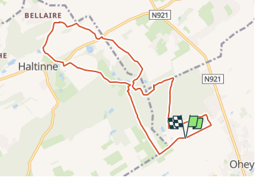
Tocht Stappen van 9,8 km beschikbaar op Wallonië, Namen, Ohey. Deze tocht wordt voorgesteld door dejongm.
Beschrijving
Très beau parcours par le hameau de Petit Wallay, le château d'Haltinne. Le retour par le lieu dit Froidebise et le Bois d'Ohey.


Plaatsbepaling
Land:
Belgium
Regio :
Wallonië
Departement/Provincie :
Namen
Gemeente :
Ohey
Locatie:
Unknown
Vertrek:(Dec)
Vertrek:(UTM)
649838 ; 5589674 (31U) N.
Opmerkingen