


Rocher de Pène Nère (tentative...)

chrisgps
Gebruiker


5h50
Moeilijkheid : Zeer moeilijk

Gratisgps-wandelapplicatie
 SityTrail
IGN / Geografische instituten
SityTrail Plus
De wereld gaat voor u open
Over ons
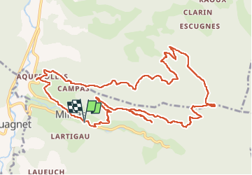
Tocht Stappen van 15,1 km beschikbaar op Occitanië, Haute-Garonne, Milhas. Deze tocht wordt voorgesteld door chrisgps.
Beschrijving
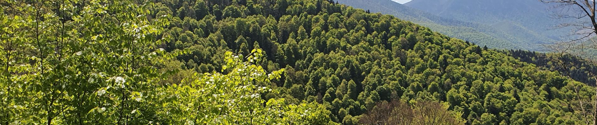
chemin peu marqué difficilement "trouvable", très encombré et par le bois mort et la végétation qui a repris sa place. De Bourrec à Hontas: l'ancien chemin est correct. Néanmoins, il a fallu rebrousser chemin à Hontas interdit d'accès par un portail cadenassé. En revenant vers Hourrec, on a récupéré un...très vieux chemin très encombré, difficile d'accès à certains endroits, pour ...enfin rejoindre la piste forestière de Paloumère.
De là pour rejoindre plus haut, sur la crète le GRP des trois vallées prendre en face d'abord la piste qui monte sévèrement,et la première a gauche, moins raide pour arriver plus tranquillement .
Foto's
 - Photo 1")
Plaatsbepaling
Opmerkingen