


Trace Montée Ventoux Guy 130525

mitch1952
Gebruiker
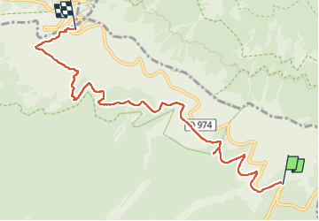

Lengte
8,2 km

Max. hoogte
1910 m

Positief hoogteverschil
573 m
Km-Effort
14,2 km

Min. hoogte
1422 m

Negatief hoogteverschil
93 m
Boucle
Neen
Datum van aanmaak :
2025-05-13 07:49:22.0
Laatste wijziging :
2025-05-13 11:19:26.732

Gratisgps-wandelapplicatie
 SityTrail
IGN / Geografische instituten
SityTrail Plus
De wereld gaat voor u open
Over ons
Tocht van 8,2 km beschikbaar op Provence-Alpes-Côte d'Azur, Vaucluse, Bédoin. Deze tocht wordt voorgesteld door mitch1952.
Plaatsbepaling
Land:
France
Regio :
Provence-Alpes-Côte d'Azur
Departement/Provincie :
Vaucluse
Gemeente :
Bédoin
Locatie:
Unknown
Vertrek:(Dec)
Vertrek:(UTM)
685425 ; 4891368 (31T) N.
Opmerkingen