


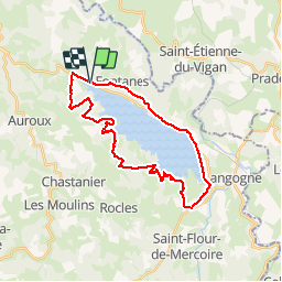
BRIGE(D26) 29 km VTT Naussac

benoit48
Gebruiker

Lengte
29 km

Max. hoogte
1071 m

Positief hoogteverschil
555 m
Km-Effort
36 km

Min. hoogte
933 m

Negatief hoogteverschil
552 m
Boucle
Ja
Datum van aanmaak :
2018-01-06 00:00:00.0
Laatste wijziging :
2018-01-06 00:00:00.0
2h15
Moeilijkheid : Medium

Gratisgps-wandelapplicatie
 SityTrail
IGN / Geografische instituten
SityTrail Plus
De wereld gaat voor u open
Over ons
Tocht Mountainbike van 29 km beschikbaar op Occitanië, Lozère, Auroux. Deze tocht wordt voorgesteld door benoit48.


Plaatsbepaling
Land:
France
Regio :
Occitanië
Departement/Provincie :
Lozère
Gemeente :
Auroux
Locatie:
Unknown
Vertrek:(Dec)
Vertrek:(UTM)
560653 ; 4957553 (31T) N.
Opmerkingen