


balade du matin

Maca8284
Gebruiker

Lengte
6,7 km

Max. hoogte
178 m

Positief hoogteverschil
43 m
Km-Effort
7,3 km

Min. hoogte
159 m

Negatief hoogteverschil
44 m
Boucle
Ja
Datum van aanmaak :
2025-05-26 06:13:55.386
Laatste wijziging :
2025-05-26 07:44:29.449
1h30
Moeilijkheid : Heel gemakkelijk

Gratisgps-wandelapplicatie
 SityTrail
IGN / Geografische instituten
SityTrail Plus
De wereld gaat voor u open
Over ons
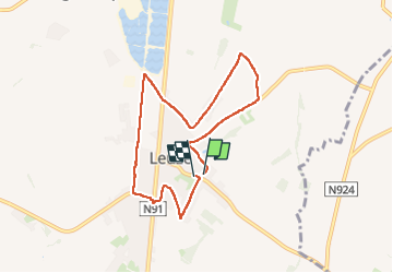
Tocht Stappen van 6,7 km beschikbaar op Wallonië, Namen, Éghezée. Deze tocht wordt voorgesteld door Maca8284.
Plaatsbepaling
Land:
Belgium
Regio :
Wallonië
Departement/Provincie :
Namen
Gemeente :
Éghezée
Locatie:
Leuze
Vertrek:(Dec)
Vertrek:(UTM)
635677 ; 5602524 (31U) N.
Opmerkingen