


Lac relyavick

manu_gps
Gebruiker

Lengte
255 m

Max. hoogte
0 m

Positief hoogteverschil
0 m
Km-Effort
255 m

Min. hoogte
0 m

Negatief hoogteverschil
0 m
Boucle
Neen
Datum van aanmaak :
2025-06-08 09:06:26.0
Laatste wijziging :
2025-06-08 09:07:15.557
0m
Moeilijkheid : Gemakkelijk

Gratisgps-wandelapplicatie
 SityTrail
IGN / Geografische instituten
SityTrail Plus
De wereld gaat voor u open
Over ons
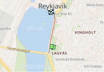
Tocht Stappen van 255 m beschikbaar op Onbekend, Reykjavik, Onbekend. Deze tocht wordt voorgesteld door manu_gps.
Plaatsbepaling
Land:
Iceland
Regio :
Onbekend
Departement/Provincie :
Reykjavik
Gemeente :
Onbekend
Locatie:
Miðborg
Vertrek:(Dec)
Vertrek:(UTM)
454245 ; 7113276 (27W) N.
Opmerkingen