Tocht Stappen Fontaines-en-Sologne - Fontaines-en-Sologne - Les étangs - Photo

Fontaines-en-Sologne - Les étangs

 guydu41
guydu41

Gebruiker

© OpenStreetMap contributors
Lengte
Lengte
12,6 km
Max. hoogte
Max. hoogte
123 m
Positief hoogteverschil
119 m
Km-Effort
Km-Effort  
14,2 km
Min. hoogte
Min. hoogte
82 m
Negatief hoogteverschil
120 m
Boucle
Boucle
Ja
Datum van aanmaak :
2025-06-19 05:50:27.973
Laatste wijziging :
2025-06-19 21:27:23.943

(0 Bericht)

Stappen
Stappen
3h05
Moeilijkheid : Gemakkelijk

Scan deze QR-code om de tocht te openen in de SityTrail-applicatie

Gratisgps-wandelapplicatie

Logo SityTrail SityTrail

IGN / Geografische instituten

SityTrail uit de App Store downloaden SityTrail uit Google Play downloaden

Logo SityTrail SityTrail Plus

De wereld gaat voor u open

SityTrail uit de App Store downloaden SityTrail uit Google Play downloaden SityTrail op Huawei AppGallery downloaden

Over ons

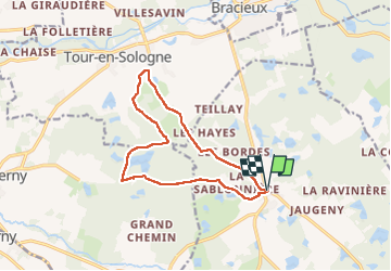
Tocht Stappen van 12,6 km beschikbaar op Centre-Val de Loire, Loir-et-Cher, Fontaines-en-Sologne. Deze tocht wordt voorgesteld door guydu41.

Beschrijving

Ce circuit en sens horaire commence depuis des aires de stationnement à côté de l'Eglise Notre-Dame de Fontaines-en-Sologne.
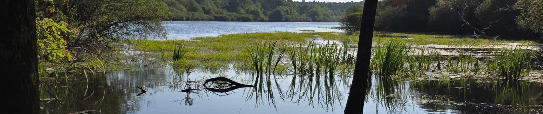
Ce parcours en très grande partie dans la forêt longe plusieurs étangs que l'on peut admirer.
La fin du circuit passe à côté d'un petit observatoire astronomique construit en 2005 et utilisé par les passionnés de l'observation du ciel.

Hoogteprofiel

Foto's

22 fotos in totaal. Klik op een foto om ze allemaal in de galerij weer te geven.

Plaatsbepaling

Land:
France
Regio :
Centre-Val de Loire
Departement/Provincie :
Loir-et-Cher
Gemeente :
Fontaines-en-Sologne
Locatie:
Unknown
Vertrek:(UTM)
390840 ; 5262802 (31T) N.


Sluiten
Mijn abonnementen