


Essai 3

castorgris
Gebruiker

Lengte
13,9 km

Max. hoogte
189 m

Positief hoogteverschil
171 m
Km-Effort
16,2 km

Min. hoogte
105 m

Negatief hoogteverschil
169 m
Boucle
Ja
Datum van aanmaak :
2025-07-04 16:00:46.0
Laatste wijziging :
2025-07-04 17:02:52.523

Gratisgps-wandelapplicatie
 SityTrail
IGN / Geografische instituten
SityTrail Plus
De wereld gaat voor u open
Over ons
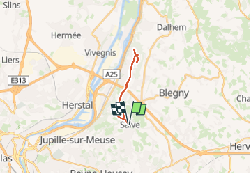
Tocht van 13,9 km beschikbaar op Wallonië, Luik, Blegny. Deze tocht wordt voorgesteld door castorgris.
Plaatsbepaling
Land:
Belgium
Regio :
Wallonië
Departement/Provincie :
Luik
Gemeente :
Blegny
Locatie:
Unknown
Vertrek:(Dec)
Vertrek:(UTM)
689523 ; 5614654 (31U) N.
Opmerkingen