


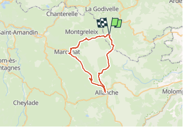
VTT3 Du col de Chamaroux Monts Cezallier cascade Veyrines Marcenat St Blaise

GrouGary
Gebruiker


3h37
Moeilijkheid : Moeilijk

Gratisgps-wandelapplicatie
 SityTrail
IGN / Geografische instituten
SityTrail Plus
De wereld gaat voor u open
Over ons
Tocht Mountainbike van 42 km beschikbaar op Auvergne-Rhône-Alpes, Puy-de-Dôme, Saint-Alyre-ès-Montagne. Deze tocht wordt voorgesteld door GrouGary.
Beschrijving
Boucle VTT3 - 42 km et 768
Petites routes D36 - D679, ...
Un petit bout de velo rail avec le détour à la cascade de Veyrines et sanctuaire Gallo-romain
Pistes/sentes entre le Col de Chamaroux (park voiture), près des Monts du Cézallier ;
Après le Col de Chamaroux, on passe près du Buron de Thioulouse Bas
Plaatsbepaling
Opmerkingen