


Rilly-sur-Vienne - le Chêne Vert Fon Bon la Roche Chandres - 20.2km 275m 5h45 (1h) - 2025 07 12

Orcal37
Gebruiker GUIDE
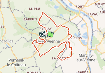

Lengte
20 km

Max. hoogte
118 m

Positief hoogteverschil
277 m
Km-Effort
24 km

Min. hoogte
38 m

Negatief hoogteverschil
279 m
Boucle
Ja
Datum van aanmaak :
2025-07-12 08:13:17.956
Laatste wijziging :
2025-07-13 13:03:04.601
5h45
Moeilijkheid : Gemakkelijk

Gratisgps-wandelapplicatie
 SityTrail
IGN / Geografische instituten
SityTrail Plus
De wereld gaat voor u open
Over ons
Tocht Stappen van 20 km beschikbaar op Centre-Val de Loire, Indre-et-Loire, Rilly-sur-Vienne. Deze tocht wordt voorgesteld door Orcal37.
Beschrijving
Rilly-sur-Vienne - le Chêne Vert - les Touches - Fon Bon - la Roche - Fon Bon - Chandres - 20.2km 275m 5h45 (1h) - 2025 07 12
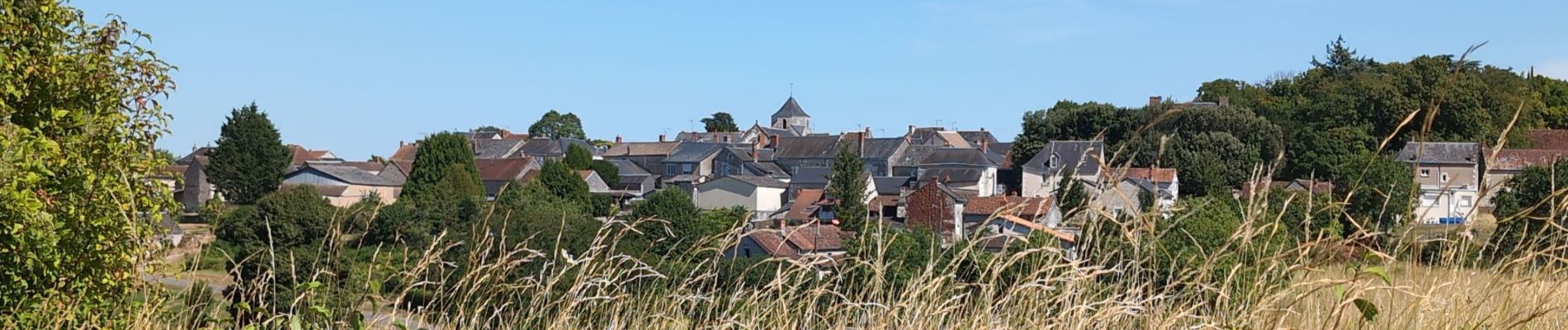
Foto's
 - 2025 07 12 - Photo 1")
 - 2025 07 12 - Photo 2")
 - 2025 07 12 - Photo 3")
 - 2025 07 12 - Photo 4")
 - 2025 07 12 - Photo 5")
 - 2025 07 12 - Photo 6")
 - 2025 07 12 - Photo 7")
 - 2025 07 12 - Photo 8")
 - 2025 07 12 - Photo 9")
 - 2025 07 12 - Photo 10")
 - 2025 07 12 - Photo 11")
 - 2025 07 12 - Photo 12")
 - 2025 07 12 - Photo 13")
 - 2025 07 12 - Photo 14")
Plaatsbepaling
Land:
France
Regio :
Centre-Val de Loire
Departement/Provincie :
Indre-et-Loire
Gemeente :
Rilly-sur-Vienne
Locatie:
Unknown
Vertrek:(Dec)
Vertrek:(UTM)
309572 ; 5214535 (31T) N.
Opmerkingen