


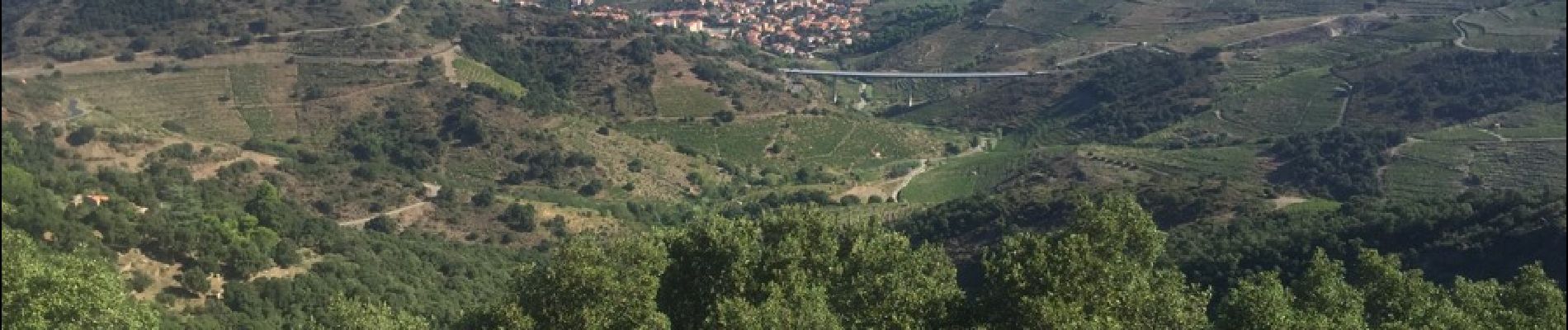
66 COLLIOURE - les balcons de Madeloc - circuit de la tour et des fortifications

jeff66
Gebruiker


2h04
Moeilijkheid : Moeilijk

Gratisgps-wandelapplicatie
 SityTrail
IGN / Geografische instituten
SityTrail Plus
De wereld gaat voor u open
Over ons
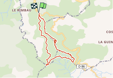
Tocht Stappen van 9,3 km beschikbaar op Occitanië, Pyrénées-Orientales, Collioure. Deze tocht wordt voorgesteld door jeff66.
Beschrijving
66 COLLIOURE - col de la serre - batterie Taillefer - tour de la Madeloc - batterie des 300 - GR10 - cols des gascons, del Fornigo, de Vallauria en passant par la Tina d'en Reig - (circuit court, dans ce sens montée vers la tour Madeloc moins raide)
Foto's


33 fotos in totaal. Klik op een foto om ze allemaal in de galerij weer te geven.
Plaatsbepaling
Opmerkingen
Très belle randonnée. Magnifique balcon sur la grand bleue et les Alberes.Pas de difficulté particulière.