Tocht Stappen Saint-Philbert-sur-Risle -        Chemin du Rossignol                     - Photo
 7217Lionel
7217Lionel

Gebruiker

© OpenStreetMap contributors
Lengte
Lengte
10,2 km
Max. hoogte
Max. hoogte
148 m
Positief hoogteverschil
260 m
Km-Effort
Km-Effort  
13,7 km
Min. hoogte
Min. hoogte
26 m
Negatief hoogteverschil
257 m
Boucle
Boucle
Ja
Datum van aanmaak :
2016-03-09 00:00:00.0
Laatste wijziging :
2016-03-09 00:00:00.0

(0 Bericht)

Stappen
Stappen
2h30
Moeilijkheid : Medium

Scan deze QR-code om de tocht te openen in de SityTrail-applicatie

Gratisgps-wandelapplicatie

Logo SityTrail SityTrail

IGN / Geografische instituten

SityTrail uit de App Store downloaden SityTrail uit Google Play downloaden

Logo SityTrail SityTrail World

De wereld gaat voor u open

SityTrail uit de App Store downloaden SityTrail uit Google Play downloaden SityTrail op Huawei AppGallery downloaden

Over ons

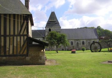
Tocht Stappen van 10,2 km beschikbaar op Normandië, Eure, Saint-Philbert-sur-Risle. Deze tocht wordt voorgesteld door 7217Lionel.

Beschrijving

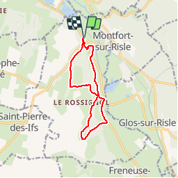
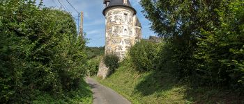
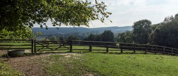
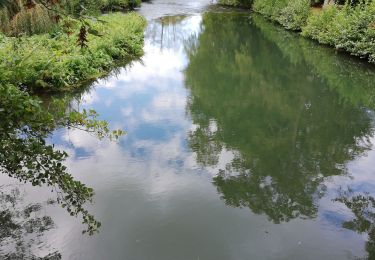
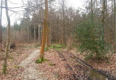
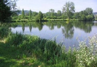
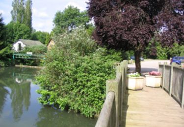
Très vallonné, bocager et forestier, ce circuit est parmi ceux qui révèlent le mieux l'identité de la vallée de la Risle avec des points forts très marqués.

Balisage: jaune

Départ: parking devant le prieuré de Saint-Philbert-sur-Risle.


Hoogteprofiel

Foto's

POI's

POI Saint-Philbert-sur-Risle - 1 - Photo
7217Lionel
SAINT-PHILBERT-SUR-RISLE 
POI Saint-Philbert-sur-Risle - 2 - Photo
7217Lionel
SAINT-PHILBERT-SUR-RISLE 
POI Saint-Philbert-sur-Risle - 3 - Photo
7217Lionel
SAINT-PHILBERT-SUR-RISLE 
POI Saint-Philbert-sur-Risle - 4 - Photo
7217Lionel
SAINT-PHILBERT-SUR-RISLE 
POI Saint-Philbert-sur-Risle - 5 - Photo
7217Lionel
SAINT-PHILBERT-SUR-RISLE 
POI Saint-Philbert-sur-Risle - 6 - Photo
7217Lionel
SAINT-PHILBERT-SUR-RISLE 
POI Saint-Philbert-sur-Risle - 7 - Photo
7217Lionel
SAINT-PHILBERT-SUR-RISLE 
POI Saint-Philbert-sur-Risle - 8 - Photo
7217Lionel
SAINT-PHILBERT-SUR-RISLE 
POI Saint-Philbert-sur-Risle - 9 - Photo
7217Lionel
SAINT-PHILBERT-SUR-RISLE 
POI Saint-Philbert-sur-Risle - 10 - Photo
7217Lionel
SAINT-PHILBERT-SUR-RISLE 
POI Saint-Philbert-sur-Risle - 11 - Photo
7217Lionel
SAINT-PHILBERT-SUR-RISLE 
POI Saint-Philbert-sur-Risle - Les quatre tours médiévales de la Baronnie - Photo
7217Lionel
SAINT-PHILBERT-SUR-RISLE 
POI Saint-Philbert-sur-Risle - vue - Photo
7217Lionel
SAINT-PHILBERT-SUR-RISLE 
POI Saint-Philbert-sur-Risle - vue2 - Photo
7217Lionel
SAINT-PHILBERT-SUR-RISLE 

Plaatsbepaling

Land:
France
Regio :
Normandië
Departement/Provincie :
Eure
Gemeente :
Saint-Philbert-sur-Risle
Locatie:
Unknown
Vertrek:(Dec)
Vertrek:(UTM)
329109 ; 5463062 (31U) N.

Wandeltochten in de omgeving

Tocht Stappen Condé-sur-Risle - Circuit des faneuses -Condé sur Risle-St Christophe sur Condé  - Photo
Stappen
MichelRando7656

Stappen

Moeilijk
Condé-sur-Risle, Normandië, Eure, France
14 km | 16,4 km-effort
4h 8min
Ja
Tocht Stappen Appeville-Annebault - Appeville Annebault - Photo
Stappen
Roulland

Stappen

Medium
(1)
Appeville-Annebault, Normandië, Eure, France
26 km | 33 km-effort
4h 42min
Ja
Tocht Stappen Montfort-sur-Risle - Montfort-sur-Risle  - Photo
Stappen
MichelRando7656

Stappen

Moeilijk
Montfort-sur-Risle, Normandië, Eure, France
21 km | 26 km-effort
7h 21min
Ja
Tocht Stappen Appeville-Annebault - appeville - Photo
Stappen
MichelRando7656

Stappen

Medium
Appeville-Annebault, Normandië, Eure, France
23 km | 29 km-effort
5h 6min
Ja
Tocht Stappen Illeville-sur-Montfort - chemin des Séquoias - Photo
Stappen
dominiquelouis

Stappen

Medium
Illeville-sur-Montfort, Normandië, Eure, France
7,8 km | 9,7 km-effort
2h 56min
Ja
Tocht Mountainbike Saint-Philbert-sur-Risle - Autour de Saint-Philbert-sur-Risle - Photo
Mountainbike
tracegps

Mountainbike

Medium
Saint-Philbert-sur-Risle, Normandië, Eure, France
38 km | 45 km-effort
3h 0min
Ja
Tocht Stappen Saint-Philbert-sur-Risle - Autour de Saint-Philbert-sur-Risle - Photo
Stappen
tracegps

Stappen

Moeilijk
Saint-Philbert-sur-Risle, Normandië, Eure, France
38 km | 45 km-effort
8h 0min
Ja
Tocht Stappen Montfort-sur-Risle - Chemin du Rond de Beuvron - Montfort sur Risle - Photo
Stappen
tracegps

Stappen

Medium
Montfort-sur-Risle, Normandië, Eure, France
11,7 km | 14,9 km-effort
3h 0min
Ja
Tocht Stappen Saint-Philbert-sur-Risle - Du Prieuré à l'Abbaye - Photo
Stappen
tracegps

Stappen

Moeilijk
Saint-Philbert-sur-Risle, Normandië, Eure, France
24 km | 30 km-effort
6h 0min
Ja


Sluiten
Mijn abonnementen