Tocht Stappen Perpignan - 66 PERPIGNAN - mas Bresson - POLLESTRES -  - Photo

66 PERPIGNAN - mas Bresson - POLLESTRES -

 jeff66
jeff66

Gebruiker

© OpenStreetMap contributors
Lengte
Lengte
7,1 km
Max. hoogte
Max. hoogte
83 m
Positief hoogteverschil
71 m
Km-Effort
Km-Effort  
8 km
Min. hoogte
Min. hoogte
44 m
Negatief hoogteverschil
73 m
Boucle
Boucle
Ja
Datum van aanmaak :
2015-09-08 00:00:00.0
Laatste wijziging :
2015-09-08 00:00:00.0

(1 Bericht)

Stappen
Stappen
1h08
Moeilijkheid : Gemakkelijk

Scan deze QR-code om de tocht te openen in de SityTrail-applicatie

Gratisgps-wandelapplicatie

Logo SityTrail SityTrail

IGN / Geografische instituten

SityTrail uit de App Store downloaden SityTrail uit Google Play downloaden

Logo SityTrail SityTrail Plus

De wereld gaat voor u open

SityTrail uit de App Store downloaden SityTrail uit Google Play downloaden SityTrail op Huawei AppGallery downloaden

Over ons

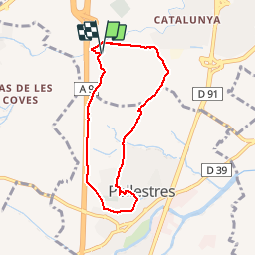
Tocht Stappen van 7,1 km beschikbaar op Occitanië, Pyrénées-Orientales, Perpignan. Deze tocht wordt voorgesteld door jeff66.

Beschrijving

66 PERPIGNAN - mas Bresson - Serrat de la garriga Dels Frares - aire des pavillons A9 - la Travessa - bassin d'orage S2566 - POLLESTRES - les Fabresses - cimetière - le long du canal - école Paul Eluard, complexe sportif les catalans de France, salle polyvalente Jordi Barre, stades, pharmacie, rond point de la légion d'honneur, rue vendémiaire, avenue Pablo Casals, chemin de la traverse, le clos des Aspres, ZAC Olympeo, le temps des vendanges, gue sur correc de la Travessa - PERPIGNAN, Agulla, mas Bresson grand et petit, canal de Perpignan

Hoogteprofiel

Plaatsbepaling

Land:
France
Regio :
Occitanië
Departement/Provincie :
Pyrénées-Orientales
Gemeente :
Perpignan
Locatie:
Unknown
Vertrek:(Dec)
Vertrek:(UTM)
488870 ; 4723007 (31T) N.

Opmerkingen

Gelieve in te loggen om een commentaar of een beoordeling achter te laten


Sluiten
Mijn abonnementen