


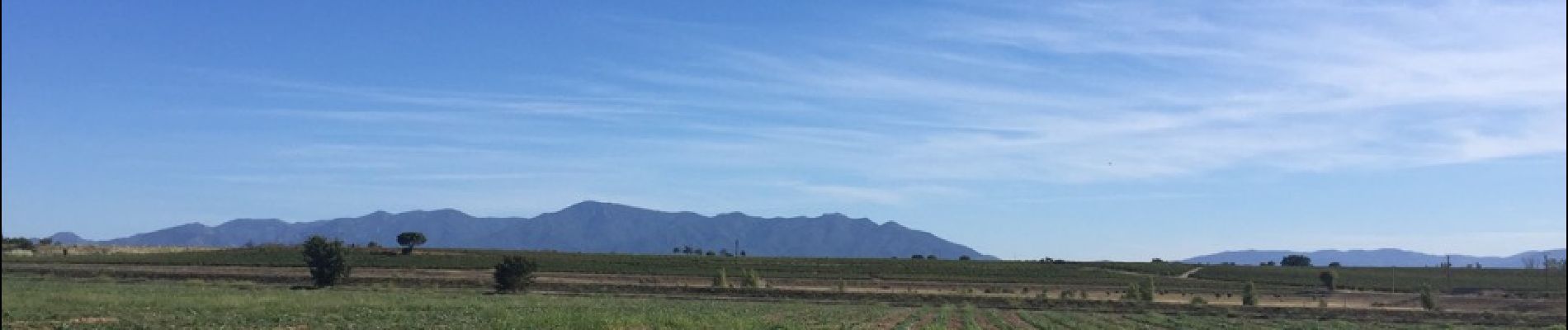
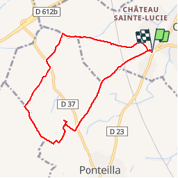
66 CANOHES - PONTEILLA par la piste cyclable, Vignobles et exploit. Arboricoles et maraîchères, entre LGV et Canal de Perpignan

jeff66
Gebruiker


1h21
Moeilijkheid : Gemakkelijk

Gratisgps-wandelapplicatie
 SityTrail
IGN / Geografische instituten
SityTrail Plus
De wereld gaat voor u open
Over ons
Tocht Stappen van 8,3 km beschikbaar op Occitanië, Pyrénées-Orientales, Canohès. Deze tocht wordt voorgesteld door jeff66.
Beschrijving
66 CANOHES - parking a la sortie du village s'a proximité de la RD23, prendre piste cyclable, qui enjambe la ligne LGV, panorama sur les Albères , le Canigou, força réal - camp Del Roure - mas saint Nicolas - les deus Animaides - els Sivres petit - els Sivres - la vigne Del REY - El Jaçal - élevage canin - emprunter la RD37, mas Manrèse - Vnyer Del SOLER - mas d'en Gallina - canal de Perpignan - les jardins d'Albert
Foto's


Plaatsbepaling
Opmerkingen