


Lacs et Col de Bousson. 04 10.15

Dervalmarc
Gebruiker
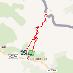

Lengte
8,1 km

Max. hoogte
2183 m

Positief hoogteverschil
323 m
Km-Effort
12,3 km

Min. hoogte
1869 m

Negatief hoogteverschil
320 m
Boucle
Ja
Datum van aanmaak :
2016-11-01 00:00:00.0
Laatste wijziging :
2016-11-01 00:00:00.0
2h24
Moeilijkheid : Gemakkelijk

Gratisgps-wandelapplicatie
 SityTrail
IGN / Geografische instituten
SityTrail Plus
De wereld gaat voor u open
Over ons
Tocht Stappen van 8,1 km beschikbaar op Provence-Alpes-Côte d'Azur, Hautes-Alpes, Cervières. Deze tocht wordt voorgesteld door Dervalmarc.
Beschrijving
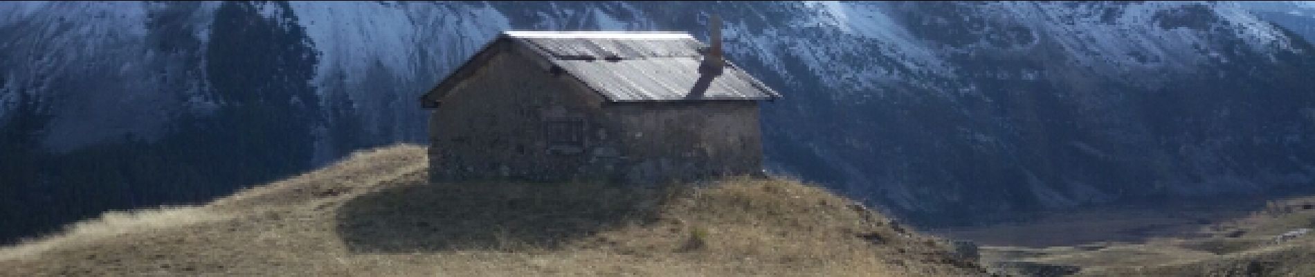
L'intérêt réside dans le faible dénivelé qui pour autant nous fait découvrir cabane d'alpage, nombreux lacs une demi douzaine, et un col frontalier.
Foto's


Plaatsbepaling
Land:
France
Regio :
Provence-Alpes-Côte d'Azur
Departement/Provincie :
Hautes-Alpes
Gemeente :
Cervières
Locatie:
Unknown
Vertrek:(Dec)
Vertrek:(UTM)
323718 ; 4971485 (32T) N.
Opmerkingen
Sans intérêt en fin d'été.