


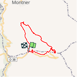
66 FORÇA RÉAL, jardin botanique, boucle versant Nord, MONTNER

jeff66
Gebruiker


1h33
Moeilijkheid : Medium

Gratisgps-wandelapplicatie
 SityTrail
IGN / Geografische instituten
SityTrail Plus
De wereld gaat voor u open
Over ons
Tocht Stappen van 6,9 km beschikbaar op Occitanië, Pyrénées-Orientales, Montner. Deze tocht wordt voorgesteld door jeff66.
Beschrijving
66 FORÇA RÉAL, coll de Bou, vue sur les corbières, LA
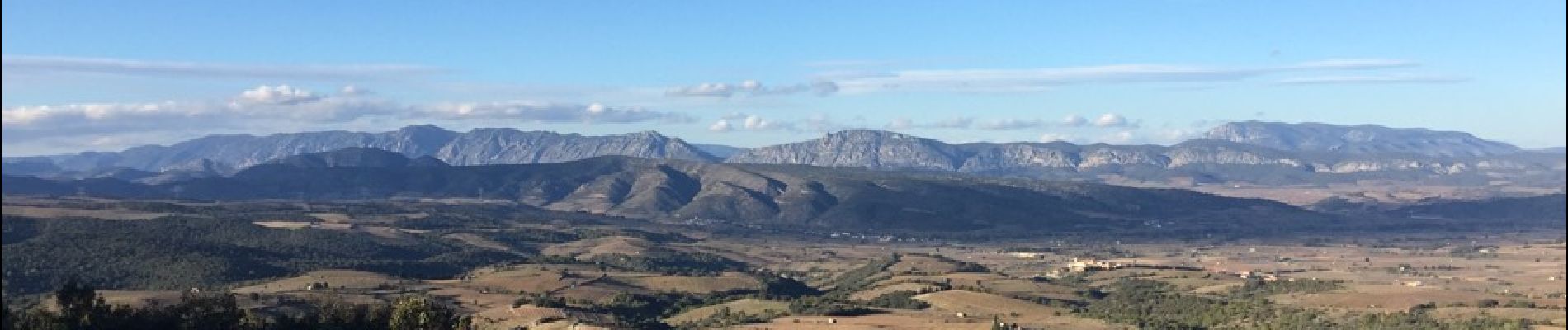
Vallée de l'agly, Sentier botanique, relai et ermitage de força réal, vue à 250 degrés sur la vallée de la Tet, la plaine, les Albères, la côte, les corbières m, la vallée de l'agly, le Canigou les Pyrénées - MONTNER - ravin de las Pichadousses
Foto's


35 fotos in totaal. Klik op een foto om ze allemaal in de galerij weer te geven.
Plaatsbepaling
Opmerkingen
Une partie du chemin n’existe plus pour la traversée du ravin