


Le Beaucet Vénasque

yjguerin
Gebruiker

Lengte
17,5 km

Max. hoogte
426 m

Positief hoogteverschil
579 m
Km-Effort
25 km

Min. hoogte
180 m

Negatief hoogteverschil
579 m
Boucle
Ja
Datum van aanmaak :
2019-05-01 07:39:51.338
Laatste wijziging :
2019-05-01 07:39:51.391
5h25
Moeilijkheid : Medium

Gratisgps-wandelapplicatie
 SityTrail
IGN / Geografische instituten
SityTrail Plus
De wereld gaat voor u open
Over ons
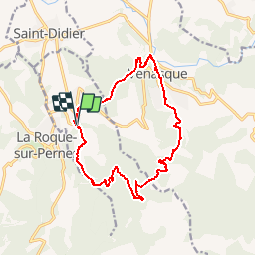
Tocht Stappen van 17,5 km beschikbaar op Provence-Alpes-Côte d'Azur, Vaucluse, Le Beaucet. Deze tocht wordt voorgesteld door yjguerin.
Beschrijving
7 h avec les Collines
Plaatsbepaling
Land:
France
Regio :
Provence-Alpes-Côte d'Azur
Departement/Provincie :
Vaucluse
Gemeente :
Le Beaucet
Locatie:
Unknown
Vertrek:(Dec)
Vertrek:(UTM)
669920 ; 4872180 (31T) N.
Opmerkingen