


Villetelle (Ambrussum)

coulombf
Gebruiker
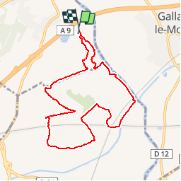

Lengte
9,6 km

Max. hoogte
50 m

Positief hoogteverschil
109 m
Km-Effort
11,1 km

Min. hoogte
12 m

Negatief hoogteverschil
109 m
Boucle
Ja
Datum van aanmaak :
2016-03-09 00:00:00.0
Laatste wijziging :
2016-03-09 00:00:00.0
2h15
Moeilijkheid : Gemakkelijk

Gratisgps-wandelapplicatie
 SityTrail
IGN / Geografische instituten
SityTrail Plus
De wereld gaat voor u open
Over ons
Tocht Stappen van 9,6 km beschikbaar op Occitanië, Hérault, Villetelle. Deze tocht wordt voorgesteld door coulombf.
Beschrijving
Avant travaux LGV
Plaatsbepaling
Land:
France
Regio :
Occitanië
Departement/Provincie :
Hérault
Gemeente :
Villetelle
Locatie:
Unknown
Vertrek:(Dec)
Vertrek:(UTM)
592414 ; 4841400 (31T) N.
Opmerkingen