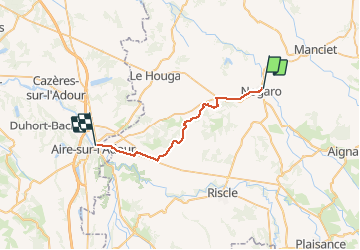
compostelle gr65 de nogaro a aire sur adour

phimar_2612
Gebruiker

Lengte
27 km

Max. hoogte
165 m

Positief hoogteverschil
302 m
Km-Effort
31 km

Min. hoogte
80 m

Negatief hoogteverschil
317 m
Boucle
Neen
Datum van aanmaak :
2016-03-09 00:00:00.0
Laatste wijziging :
2016-03-09 00:00:00.0
--
Moeilijkheid : Medium

Gratisgps-wandelapplicatie
 SityTrail
IGN / Geografische instituten
SityTrail Plus
De wereld gaat voor u open
Over ons
Tocht Stappen van 27 km beschikbaar op Occitanië, Gers, Nogaro. Deze tocht wordt voorgesteld door phimar_2612.
Plaatsbepaling
Land:
France
Regio :
Occitanië
Departement/Provincie :
Gers
Gemeente :
Nogaro
Locatie:
Unknown
Vertrek:(Dec)
Vertrek:(UTM)
739000 ; 4849583 (30T) N.
Opmerkingen