


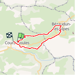
Coursegoules Bezaudun les Alpes

GrouGary
Gebruiker

Lengte
13,2 km

Max. hoogte
1389 m

Positief hoogteverschil
660 m
Km-Effort
22 km

Min. hoogte
867 m

Negatief hoogteverschil
689 m
Boucle
Neen
Datum van aanmaak :
2016-04-10 00:00:00.0
Laatste wijziging :
2016-04-10 00:00:00.0
5h01
Moeilijkheid : Medium

Gratisgps-wandelapplicatie
 SityTrail
IGN / Geografische instituten
SityTrail Plus
De wereld gaat voor u open
Over ons
Tocht Stappen van 13,2 km beschikbaar op Provence-Alpes-Côte d'Azur, Alpes-Maritimes, Coursegoules. Deze tocht wordt voorgesteld door GrouGary.
Beschrijving
Rando facile printemps
Plaatsbepaling
Land:
France
Regio :
Provence-Alpes-Côte d'Azur
Departement/Provincie :
Alpes-Maritimes
Gemeente :
Coursegoules
Locatie:
Unknown
Vertrek:(Dec)
Vertrek:(UTM)
342681 ; 4850878 (32T) N.
Opmerkingen