


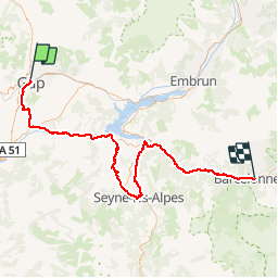
2016-06-14 Gap - Barcelonnette 92km

Lucquiaud
Gebruiker

Lengte
92 km

Max. hoogte
1368 m

Positief hoogteverschil
1919 m
Km-Effort
116 km

Min. hoogte
601 m

Negatief hoogteverschil
1531 m
Boucle
Neen
Datum van aanmaak :
2018-09-15 15:05:15.583
Laatste wijziging :
2018-09-15 15:05:15.985
6h42
Moeilijkheid : Moeilijk

Gratisgps-wandelapplicatie
 SityTrail
IGN / Geografische instituten
SityTrail Plus
De wereld gaat voor u open
Over ons
Tocht Fiets van 92 km beschikbaar op Provence-Alpes-Côte d'Azur, Hautes-Alpes, Gap. Deze tocht wordt voorgesteld door Lucquiaud.
Plaatsbepaling
Land:
France
Regio :
Provence-Alpes-Côte d'Azur
Departement/Provincie :
Hautes-Alpes
Gemeente :
Gap
Locatie:
Gap
Vertrek:(Dec)
Vertrek:(UTM)
268417 ; 4938914 (32T) N.
Opmerkingen