


roquesteron sigale

barney06
Gebruiker
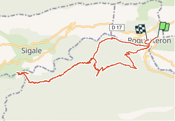

Lengte
14 km

Max. hoogte
679 m

Positief hoogteverschil
688 m
Km-Effort
23 km

Min. hoogte
315 m

Negatief hoogteverschil
679 m
Boucle
Neen
Datum van aanmaak :
2016-06-26 00:00:00.0
Laatste wijziging :
2016-06-26 00:00:00.0
6h08
Moeilijkheid : Gemakkelijk

Gratisgps-wandelapplicatie
 SityTrail
IGN / Geografische instituten
SityTrail Plus
De wereld gaat voor u open
Over ons
Tocht Stappen van 14 km beschikbaar op Provence-Alpes-Côte d'Azur, Alpes-Maritimes, Roquestéron. Deze tocht wordt voorgesteld door barney06.
Beschrijving
marche
Plaatsbepaling
Land:
France
Regio :
Provence-Alpes-Côte d'Azur
Departement/Provincie :
Alpes-Maritimes
Gemeente :
Roquestéron
Locatie:
Unknown
Vertrek:(Dec)
Vertrek:(UTM)
340026 ; 4859895 (32T) N.
Opmerkingen