


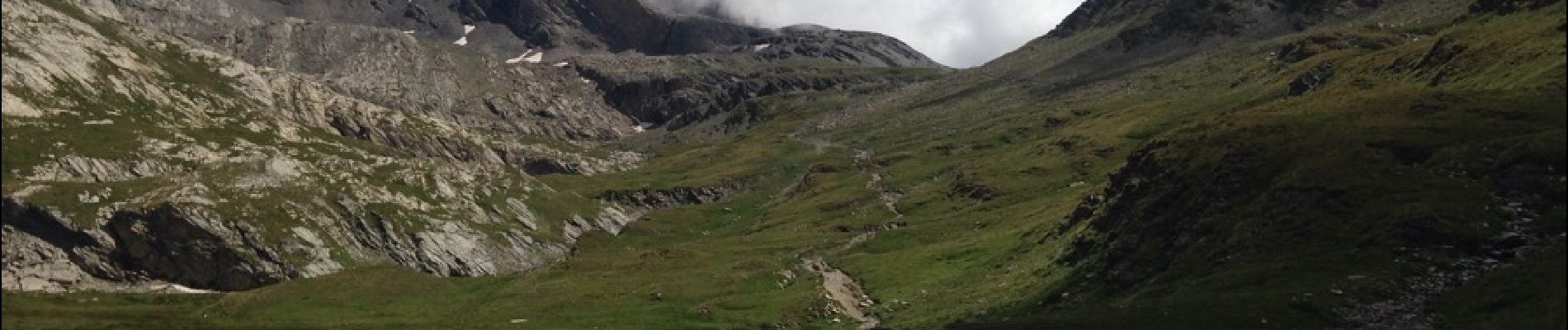
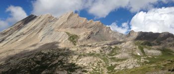
col vieux et lac Foréant

rochedaniel
Gebruiker
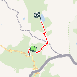

Lengte
2,9 km

Max. hoogte
2809 m

Positief hoogteverschil
176 m
Km-Effort
5,3 km

Min. hoogte
2622 m

Negatief hoogteverschil
178 m
Boucle
Neen
Datum van aanmaak :
2016-08-09 00:00:00.0
Laatste wijziging :
2016-08-09 00:00:00.0
1h05
Moeilijkheid : Gemakkelijk

Gratisgps-wandelapplicatie
 SityTrail
IGN / Geografische instituten
SityTrail Plus
De wereld gaat voor u open
Over ons
Tocht Stappen van 2,9 km beschikbaar op Provence-Alpes-Côte d'Azur, Hautes-Alpes, Molines-en-Queyras. Deze tocht wordt voorgesteld door rochedaniel.
Beschrijving
très fréquenté
Foto's


Plaatsbepaling
Land:
France
Regio :
Provence-Alpes-Côte d'Azur
Departement/Provincie :
Hautes-Alpes
Gemeente :
Molines-en-Queyras
Locatie:
Unknown
Vertrek:(Dec)
Vertrek:(UTM)
339627 ; 4950566 (32T) N.
Opmerkingen